in the news (146)


VOLCANIC LEGACY SCENIC BYWAY
5 photo(s)

june 2012 | by ben speidel

I recently had the opportunity to leave my desk and get into the field for the installation of the Volcanic Legacy Scenic Byway sign that we developed for ODOT. I was surprised at both the beauty and ruggedness of the terrain in Southern Oregon!

I was seven the last time I visited the Crater Lake area and all I remember of that trip was the inside of my grandparent's motor home, feeding slightly overweight chipmunks, and how Gramps used duct tape to fix everything from a hole in his pants to a cut my brother received when he "tripped" right in front of me. Needless to say, I was able to appreciate the majesty of the mountains and high desert forest in an entirely new way this time around.

The sign we installed is just northeast of Crater Lake in Chemult, OR at the crossroads of HWY 138 and HWY 97. When we arrived on site, the four - hour drive from Portland seemed well worth it. Standing at the base of Oregon's beautiful Cascade Mountains - a mountain range born of the Pacific Ring of Fire - I couldn't help but contemplate for a moment the ominous and fiery origins of the lofty peaks that rose before me.

CATHEDRAL ROCK
11 photo(s)

may 2012 | by kathy hocker | show project

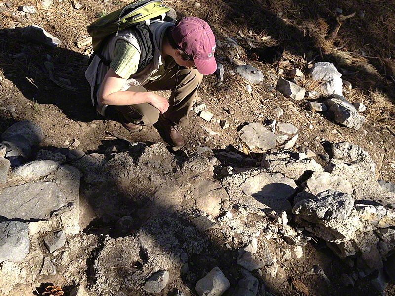
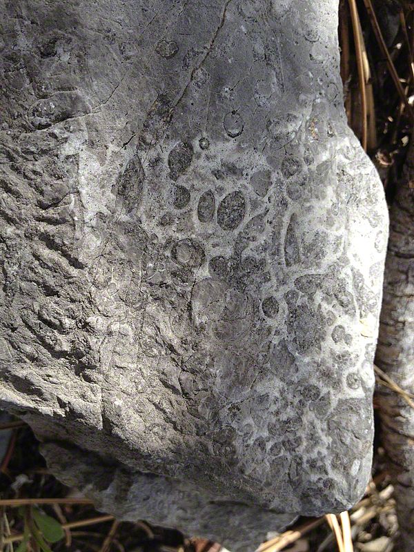
Sue was up ahead, following the proposed trail route through serviceberry brush, ponderosa, white fir, and aspen. We were scoping the site for avalanche evidence, and I knew I should catch up, but... wait... what's that shape in that rock? I stooped down for a closer look: a circular fossil with small radiating lines - probably a rugose coral. And what about that one? And that one? I knew I should catch up, but my naturalist's soul was tuned to the Carboniferous, and I just couldn't tune out.

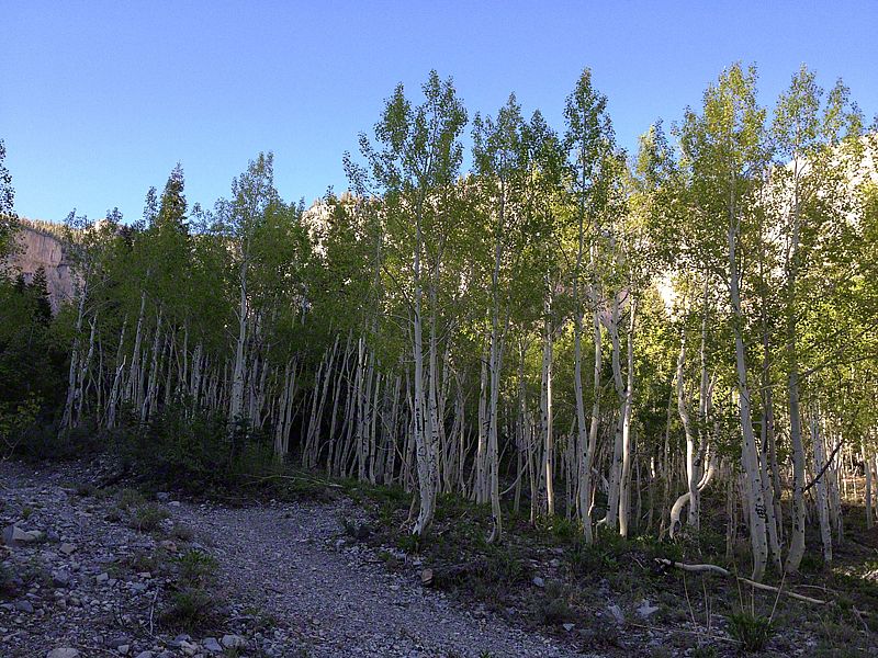
The Spring Mountains are an island of tall limestone peaks that rise from the Mojave Desert just a few miles west of Las Vegas. They're truly a world apart: thousands of feet above the cracked desert floor, draped in cool pine forest and tundra. Our job is to create interpretive and orientation exhibits for this very popular National Recreation Area.

On a breezy May morning, geologist Steve Rowland of UNLV met us for a walk down the planned Kyle Canyon Trail and an expedition to Cathedral Rock Picnic Area. By noon, his experience, knowledge, and love of the subject had tuned our ears to the stories in the stones - and the stories were spellbinding.

The strange formations along the road to Kyle Canyon told of wetter, Pleistocene climates when perennial streams tumbled stones down from the peaks, filling the canyon with hundreds of feet of rubble. Gradually, calcite deposits cemented the rubble into "fanglomerate" and flash floods sculpted it into the hoodoos and cave-riddled escarpments that line the road.

The varying hues of limestone in Mummy Mountain, Cockscomb Ridge, and Mt. Charleston told of rising and falling sea levels, and an Antarctic ice cap that waxed and waned on a timescale that ran into the tens of millions of years.

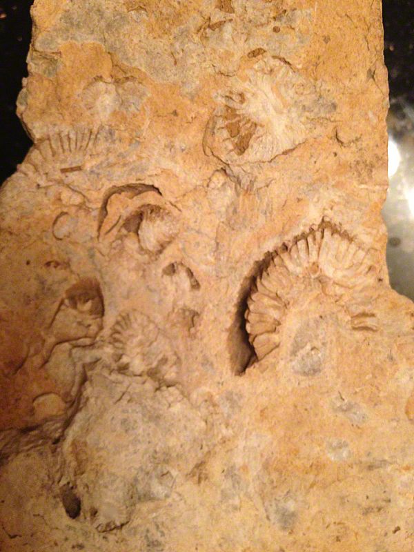
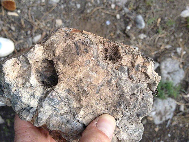
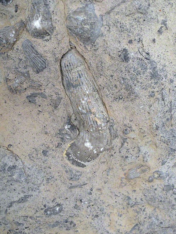
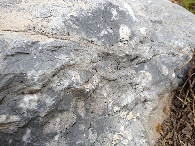
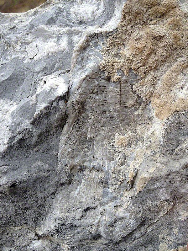
And those pale shapes in the gray boulders and pebbles? Cones, ovals, circles, fans, reticulations... Over 300 million years ago, when there were dragonflies the size of ravens, and dinosaurs were still almost 100 million years in the future, this place lay at the bottom of a shallow sea - and these rocks were reefs, alive with horn corals, brachiopods, crinoids, and bryozoans.

No wonder that for our last half-day, as we explored the site and discussed our interpretive approach, our eyes strayed again and again to the rocks below, above, and around. Fossils, seas, sharks and floods... the rocks were telling their stories, and we couldn't stop listening.

MCR DEPOT (OR EXHIBITS IN A BOX)
45 photo(s)

april 2012 | by susan jurasz | show project

After several months of fabrication, we are finally in North Dakota to install exhibits in the old Midland Continental Railroad train depot. Every day brings on a new layer of complexity and intrigue to the design. Even though we have all been working on the project, no single person, other than our art director, Peter, really has a concept of how all the pieces will fit together. And it seems there are thousands of pieces to consider.

We start with empty rooms. Exhibits get unloaded. They get unwrapped from miles of bubblewrap and foam. The pieces are sorted by room and by type. Hardware is counted and organized. Tools appear and disappear, handed from one person to the next, and a rhythm of teamwork develops. Everyone has a job and the work is steady. Every now and then, someone takes a break and walks through to see the progress, snapping a few photos to document the slow unfolding. At the end of the day, we close up shop, stiff and tired, but satisfied with the day's work. This is the most exhilarating work there is - to see a visitor center come alive after months of planning, design, and fabrication. A work of passion.

PALO ALTO BATTLEFIELD
22 photo(s)

april 2012 | by susan jurasz

There is a certain look and feel to National Parks. There is a sense of history, commemoration, and pride - pride in being an American.

The project at the Palo Alto Battlefield National Historic Park, in Brownsfield, Texas placed us on the border between Mexico and the US. Only, it was not my picture of a US border with armed police and border patrol, instead it is a long meandering river - the Rio Grande - that creates the border. A slow moving, green river that has so many bends, it is difficult to say which side you are on at any given turn in the road. Every other car has a Mexico license plate, and everyone speaks Spanish and English fluently, it feels more like a foreign country parading as a US suburb than an American town. The battle fought at this historic battlefield determined this boundary.

On April 12, 2012, Sea Reach completed the monument sign to the Park.

NEZ PERCE WORK GROUP
1 document with 4 pages

march 2012 | by susan jurasz

Our first meeting with the Nez Perce in Lapway, Idaho was rich in stories, memories, and inspiration. The tribal working group ranged in age from early twenties to late seventies and everyone was connected to the trail in some way. Torn between the desire to tell the story of the anguished flight from their homelands as one of false promises and extreme sadness or telling it as a story of survival and pride, we decided that whatever the emotion, it needed to be powerful.

So we began with art. Art transcends the boundaries of culture and words. In the style of a graphic novel, the images are powerful with human emotion and draw you into to the story. The life-size images make an immediate connection with the viewer and opens up the imagination as the story unfolds.

CAN YOU HEAR ME NOW?
1 photo(s)

march 2012 | by susan jurasz | show project

The Oregon Travel Experience is expanding its reach through visitor information travel kiosks, historical markers, the heritage tree program and now cell phone interpretation. Sea Reach developed a series of cell phone tour poles to install at various sites across Oregon, in an effort to provide a more detailed level of interpretation to interested travelers.

I THINK I SEE THE END OF THE TUNNEL...
3 photo(s)

february 2012 | by peter reedijk

I hung my head out the car window, as our wheels whirled over the tracks, peering in the dark for the light at the end of the tunnel. "Oh no! It's the train," Linda shrieked behind me. No way, it is supposed to be on a schedule and cars are not allowed in the tunnel if there is a train coming. But it sure did look like the headlight on a train. The four of us sat staring into the distance, questioning what we saw, as we sped toward the light. After a minute of silence (that is a long time in a narrow tunnel) we began to see the wet stone walls around us take shape in the daylight coming through the narrow arched entrance, and sure enough there was a train... waiting for passage through the Anton Anderson Memorial Tunnel.

The Portage Valley outside Anchorage Alaska, is best known for its glaciers. But as the glacier recedes, the rich stories that surround this isthmus that nearly connects the beluga whales in Turnigan Arm with the tufted puffins of Prince William Sound, come alive. This is place where busloads of tourists from all over the world meet the wilds of Alaska; a place that the folks in Anchorage call their back yard. Sea Reach will be developing an interpretive plan and over 40 exhibits to celebrate this amazing place.

SOLAR ARRAYS: BALDOCK REST AREA
3 photo(s)
0 layout(s)

february 2012 | by susan jurasz

I thought the best place for a solar panel would be in the Sahara Desert, but it turns out, this is not true! Photovoltaic cells create a platform where photons (light) excites electrons into a higher state of energy, producing an electric current. These cells need light - not heat. So, solar panels work as well in cool weather (actually better) than they do in hot weather. All they need is access to light.

The Oregon Department of Transportation is in the process of covering vast areas of land, designated as highway right-of-ways, with solar arrays. These solar arrays can generate enough electricity to cover nearly all of the electrical expenses associated with the state highways from street lights to rest stops. And it all comes from the sun - even on a cloudy day!

Sea Reach designed, fabricated, and installed four exhibits introducing a large solar array installed at the Baldock Rest Area. To celebrate the clear sky and sunshine, the exhibit structures are powdercoated bright blue and sunshine-yellow. Bursting out of each exhibit is a three-dimensional title band with a sun and a photovoltaic cell.

COLORFUL PATHWAYS
7 photo(s)
0 layout(s)

february 2012 | by peter reedijk

With winter retreating, work has begun on the "waterlines" for the East Bay Plaza in the city of Olympia. Featuring water themed quotes from around the world, the waterlines are colorful designs that crisscross the plaza.

After completing the design work toward the end of last year, we converted our waterline designs into mosaics. With testing complete and a clear window in the damp weather, the first mosaics were embedded into the concrete pathways surrounding the new children's museum. The colorful lines create a lively pattern in contrast with the concrete paths, structures and stones in the created stream landscape. We're expecting to completed project by the end of May.

MIDLAND CONTINENTAL RAILROAD DEPOT
2 photo(s)
0 layout(s)

january 2012 | by megan whitaker | show project

Peggy Lee, not a singer that usually comes to mind nowadays outside of a jazz bar. But for months now, I've been working to dig up images for Midland Continental Train Depot in Wimbledon, North Dakota where Peggy Lee lived during her high school years. I've read the autobiography, the biography, and played enough of her music at home that one day while shopping at a local grocery store with my kids, my 11-year-old daughter excitedly pointed out, "Hey Mom, that's Peggy Lee on the musak thing." Nearby was an elderly couple who raised their eyebrows and said, "Wow, didn't know anyone under 50 even knew who she was anymore."

The Midland Continental was a short line railroad that operated between 1912 and 1970. Originally intended to be a north-south transcontinental line stretching from Winnipeg, Manitoba to Galveston, Texas, all that was ultimately constructed were about 70 miles of track between Wimbledon and Edgeley, North Dakota. Norma Egstrom, known to the world as Peggy Lee, was a product of the railroad. Her father was a depot agent for the Midland Continental Railroad for a number of years. After she graduated from high school in Wimbledon in 1937, she quickly followed her own talents and became a household name with singing and songwriting talents.

Sea Reach designed, fabricated and installed the exhibits in this two story, 3,000 square foot depot.

left left
showing
left left